PDF Terrain — Survey to 3D Terrain Generator
Part of: FederatedModel Spatial Database · Bonsai addon for Blender
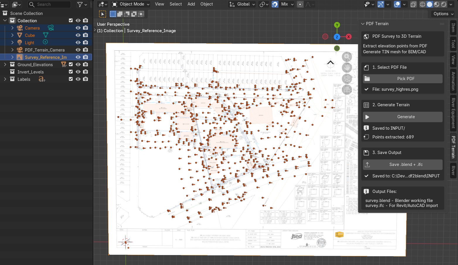
Status: POC complete. 689 elevation points extracted from real civil survey.
What It Does
Converts survey drawings (PDF/PNG) into 3D terrain for BIM workflows:
PDF survey → Google Vision OCR → elevation points → 3D point cloud → IFC + DXF
A civil engineer's survey plan — the paper document with handwritten elevation numbers — becomes a 3D terrain mesh that the BIM Compiler can place buildings on. This is the bridge between land survey and spatial MRP.
Why It Matters for the ERP Paradigm
In iDempiere, a C_Project groups C_Orders on a site. But a site is not flat — it has topology (slopes, ridges, drainage paths). The terrain mesh provides the physical surface that M_Locator plots sit on. Without terrain, plot placement is 2D grid arithmetic. With terrain, it becomes real-world site engineering:
- Cut-and-fill volumetrics — how much earth to move
- Grading strategy — which plots need fill, which need cut
- Infrastructure routing — drainage follows terrain slope
- 4D scheduling — earthworks before foundations
Key Features
- Automatic elevation point extraction via Google Vision API
- API caching — one-time call per survey, no repeat charges
- IFC export (IfcGeographicElement per point, under IfcSite)
- DXF export for AutoCAD/Civil 3D compatibility
- Orthographic camera view for technical review
- Reference image overlay in Blender viewport
Proof of Concept
| Metric | Value |
|---|---|
| Points extracted | 689 from real civil survey |
| Survey area | 294m × 229m |
| Elevation band | 20m (40m–60m) |
| Coordinate accuracy | Affine-transformed from pixel to world |
| Exports | IFC + DXF verified in Revit and AutoCAD |
How It Connects
| Dimension | Role |
|---|---|
| 3D | Terrain mesh — the physical site surface |
| 4D | Earthworks sequencing (cut before fill, grade before foundations) |
| 5D | Cut-and-fill volumes × earth-moving rates = site preparation cost |
| Infrastructure | Road/rail alignment follows terrain topology |
Source
Repository: red1oon/IfcOpenShell
(branch: feature/IFC4_DB)
See INFRA_DESIGNER_SRS.md for the infrastructure designer that consumes terrain data (4 snap modes: ON_SURFACE, ABOVE, BELOW, PIER).